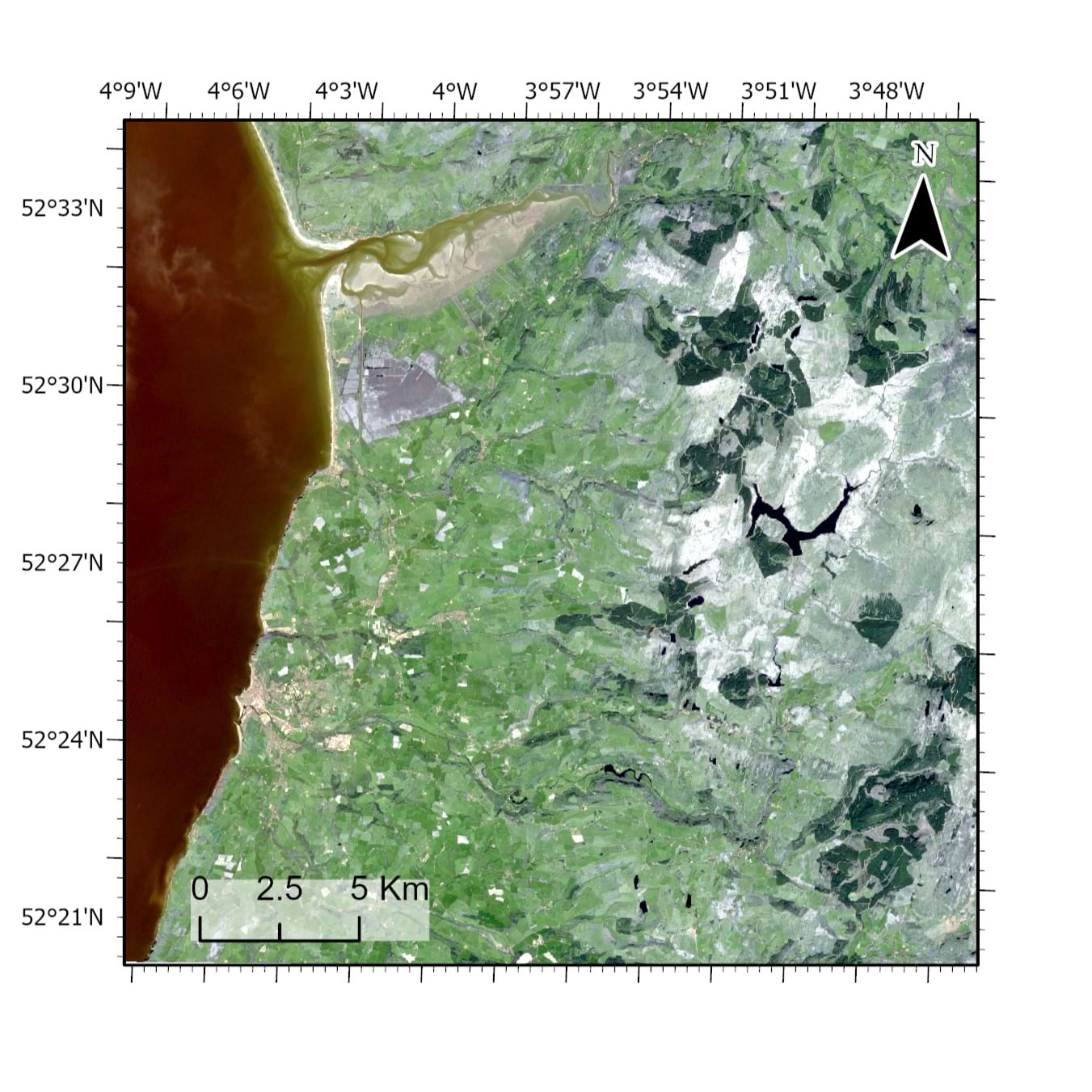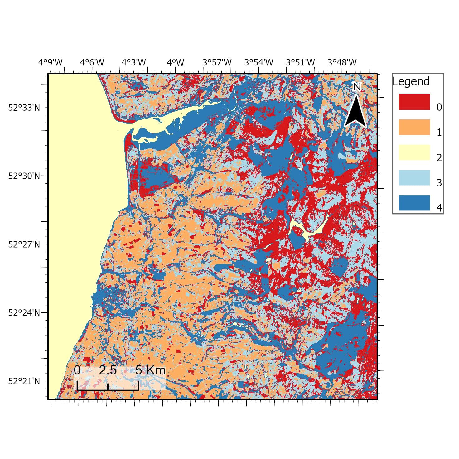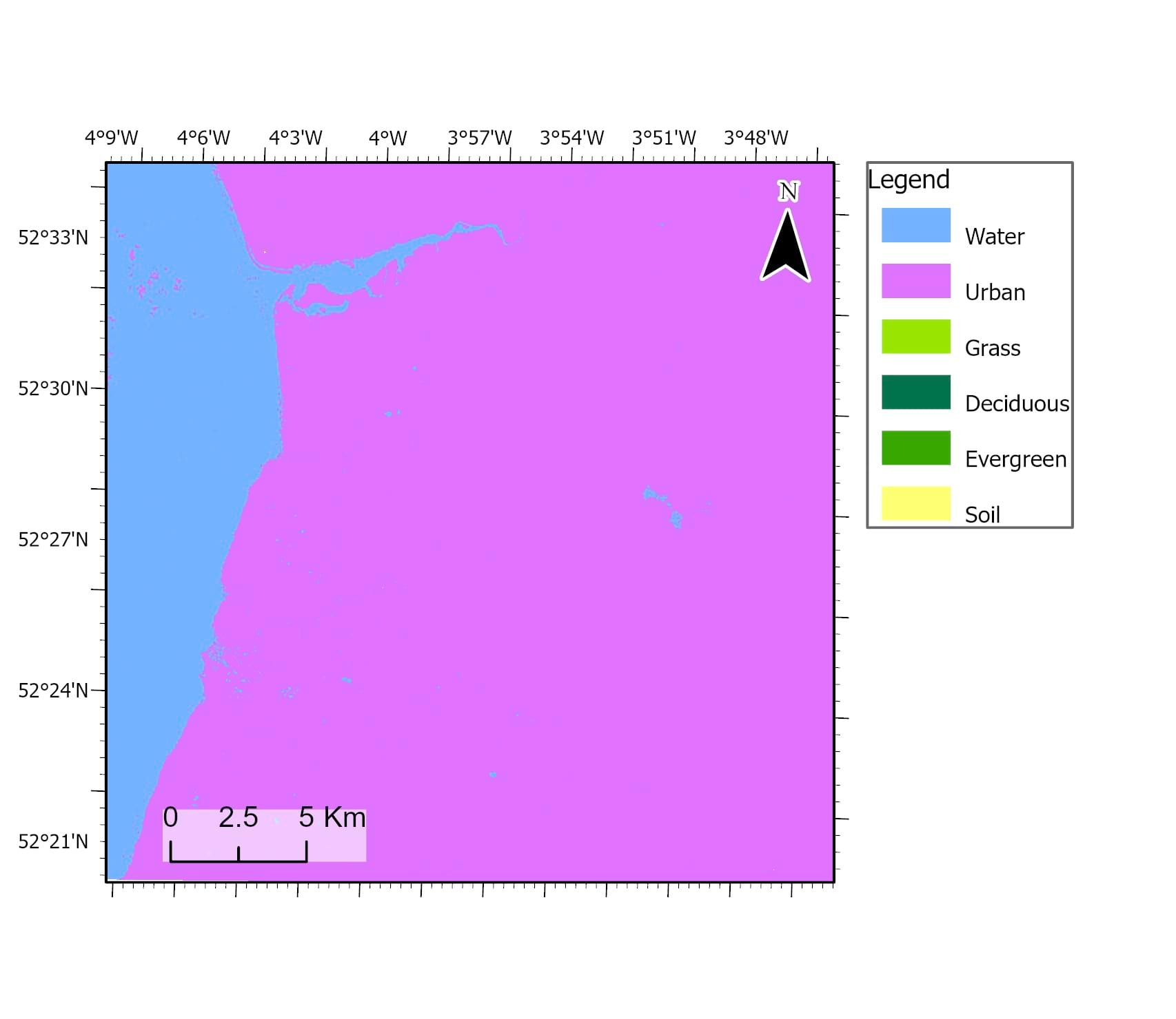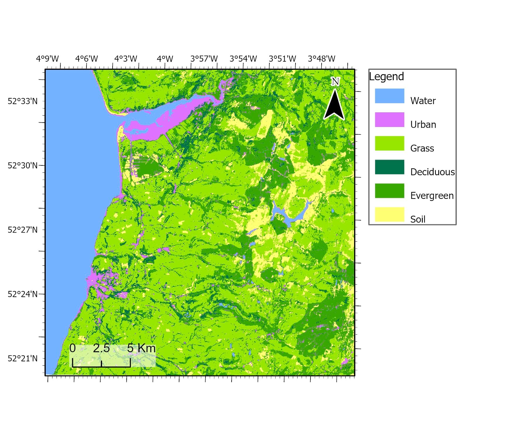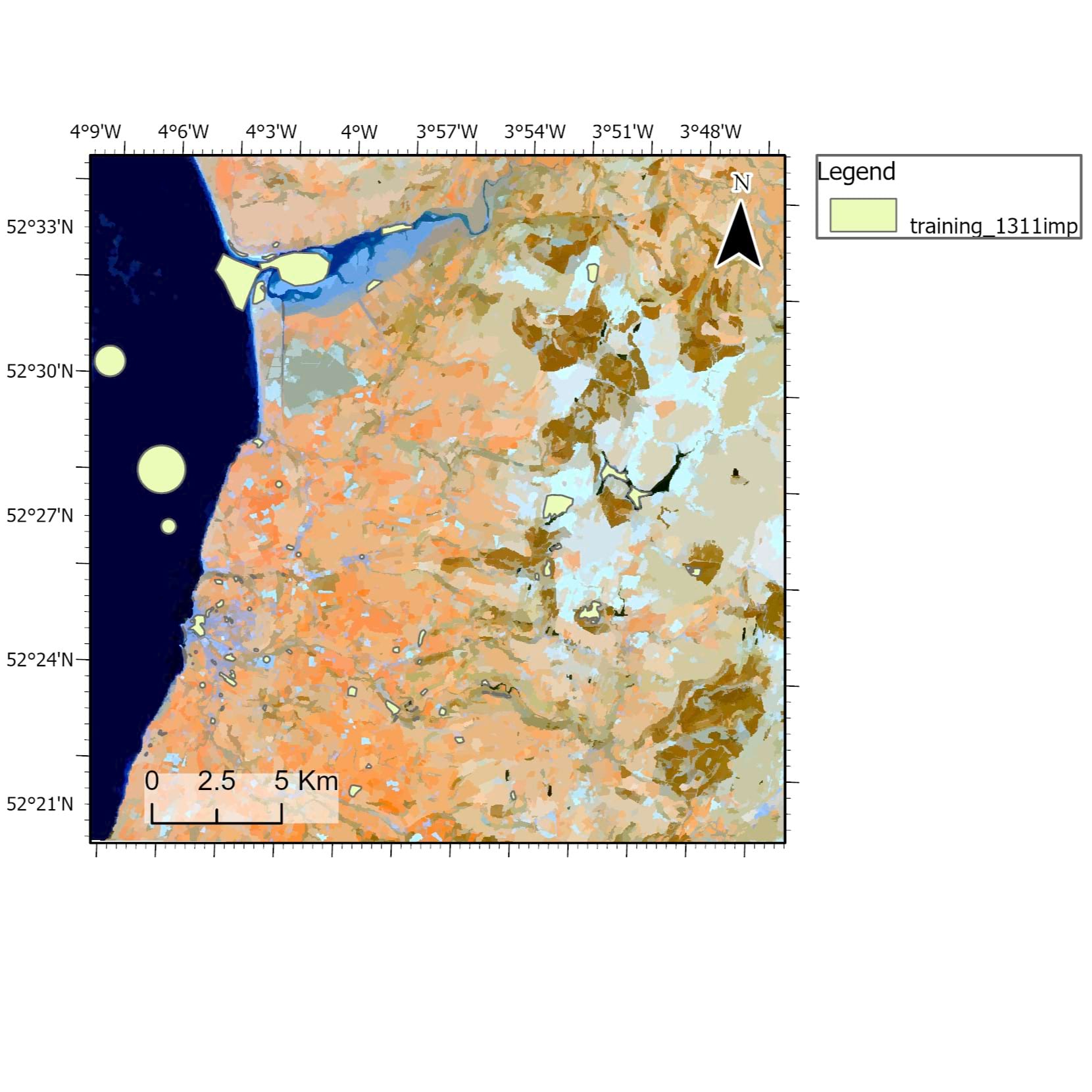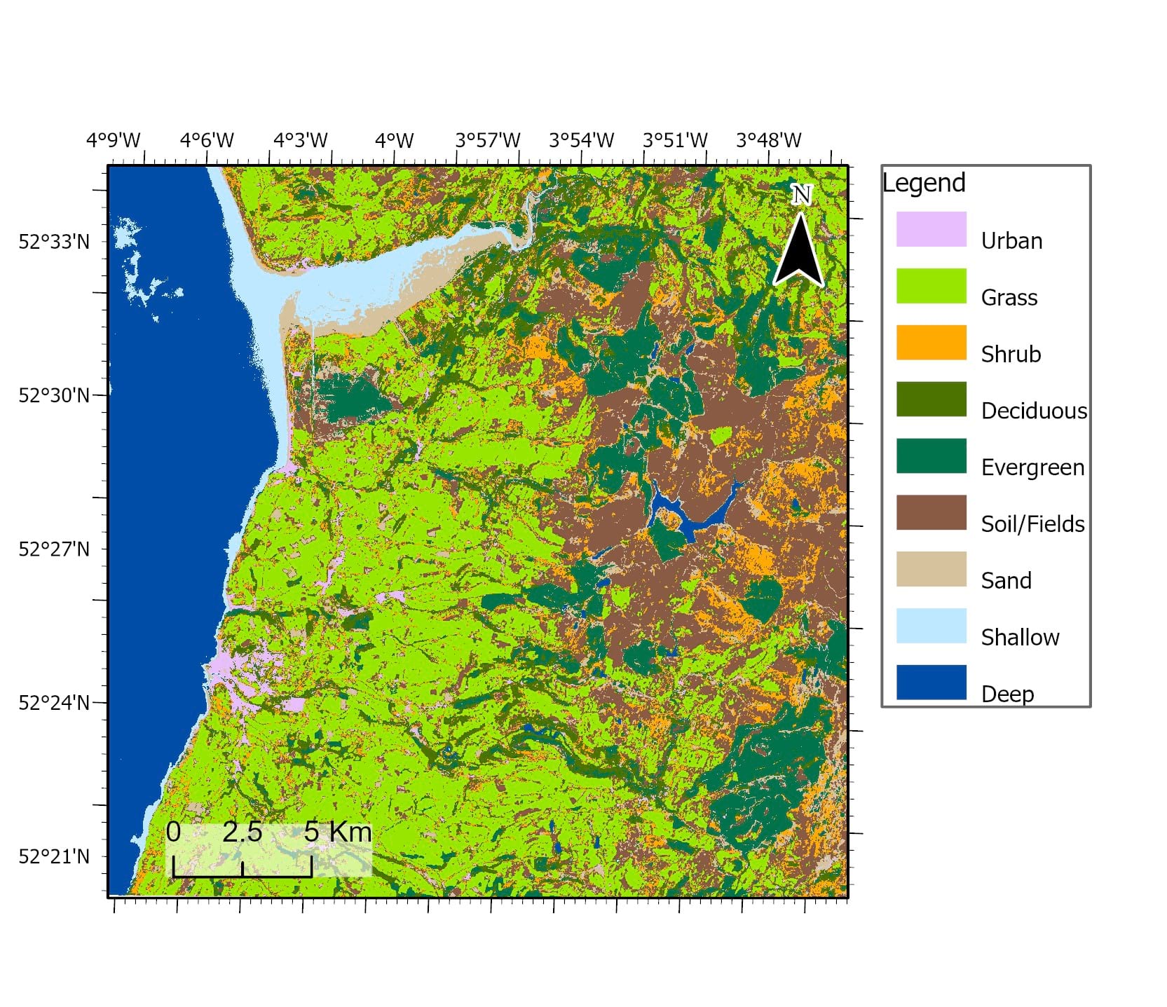
This study compares supervised and unsupervised classification methods using Sentinel-2 multispectral data over Aberystwyth, Wales, to evaluate which algorithm produces the highest land cover classification accuracy.
Accurate land cover mapping is essential for environmental monitoring, land management, and change detection in dynamic landscapes.
Compare parametric and non-parametric classification methods and identify the most suitable approach for land cover mapping.
Sentinel-2 imagery was processed in ArcGIS Pro using ISO Cluster, Maximum Likelihood, Random Trees, and Support Vector Machine classifiers.Image segmentation and supervised training samples were applied.
Sentinel-2 multispectral satellite imagery (13 bands) covering a 30 km² area around Aberystwyth, Wales.
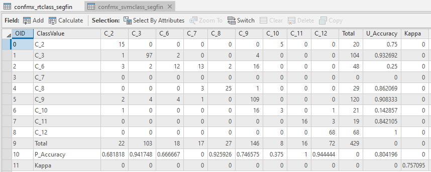
Support Vector Machine achieved the highest accuracy (~80%) and Kappa (~0.75), outperforming Random Trees (~75% accuracy).SVM provided more stable classification results across land cover classes.
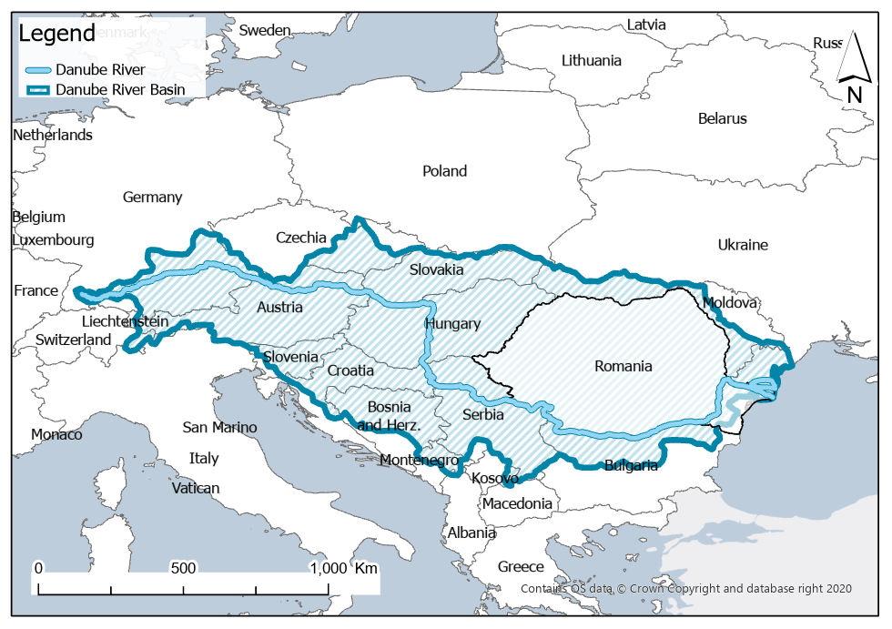
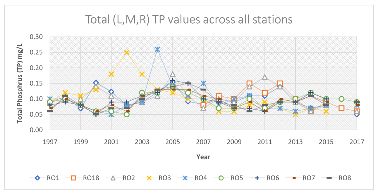
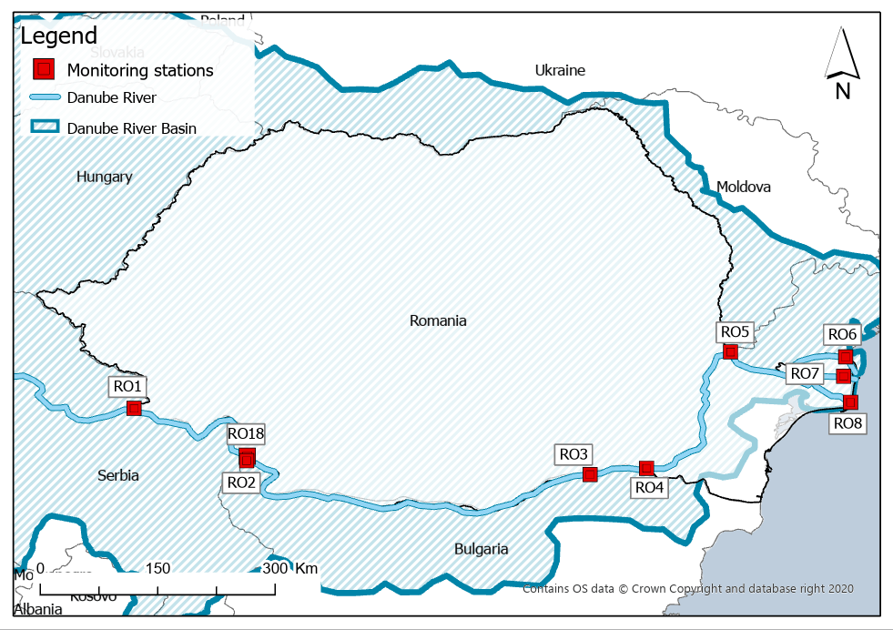
This study evaluates long-term patterns of Total Phosphorus (TP) in the Lower Danube River using monitoring data from 1997–2017. Monitoring Total Phosphorus (TP) is essential for assessing nutrient pollution, as elevated concentrations can lead to eutrophication and degradation of aquatic ecosystems. The aim was to assess water quality and identify seasonal, spatial, and temporal trends across nine Romanian monitoring stations.
Assess water quality and detect seasonal, spatial, and long-term trends in Total Phosphorus concentrations along the Romanian Danube.
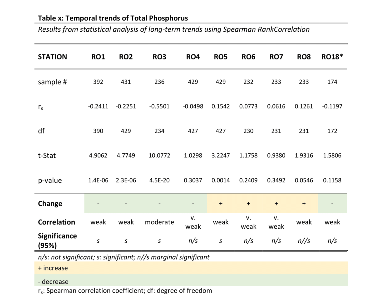
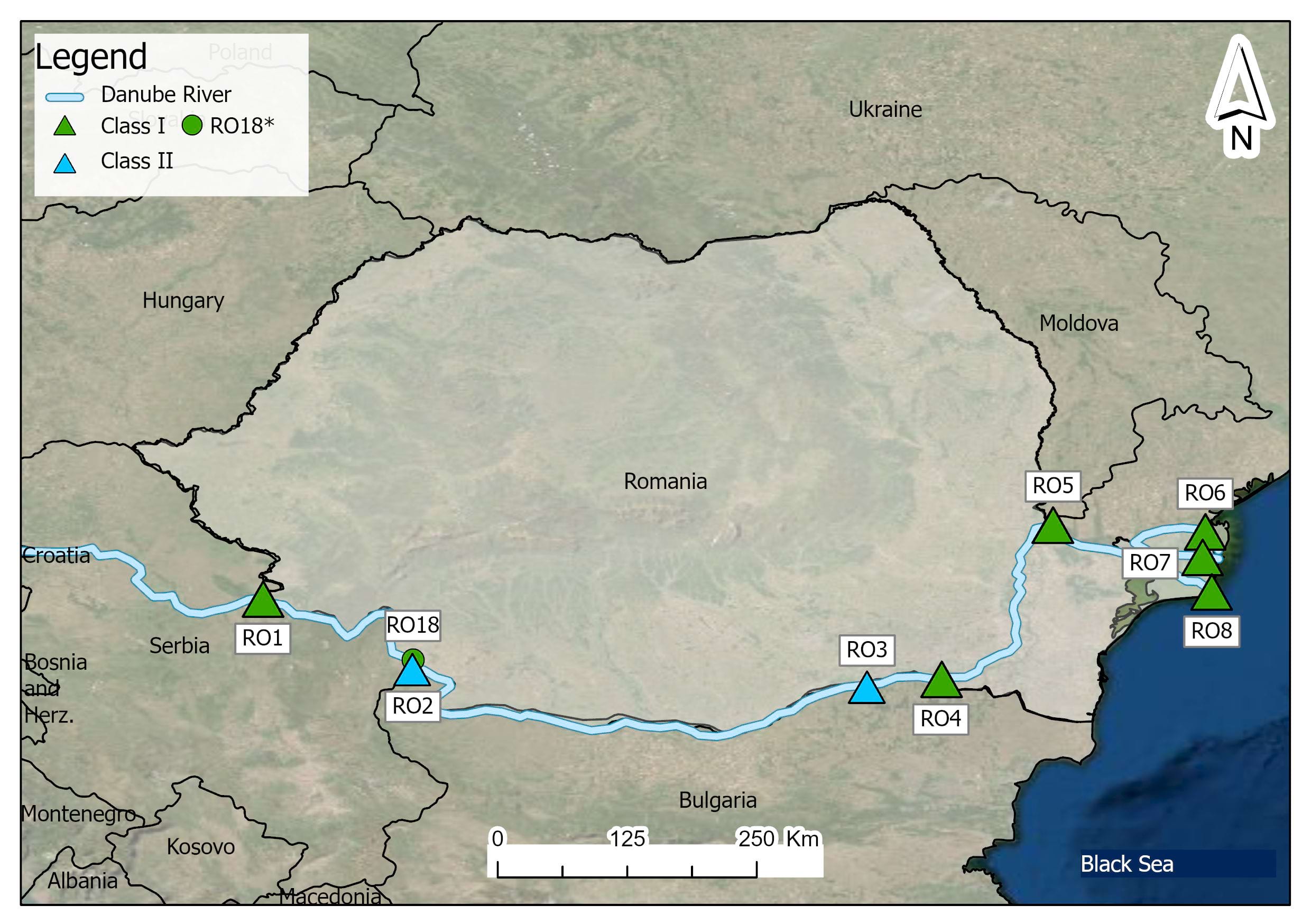
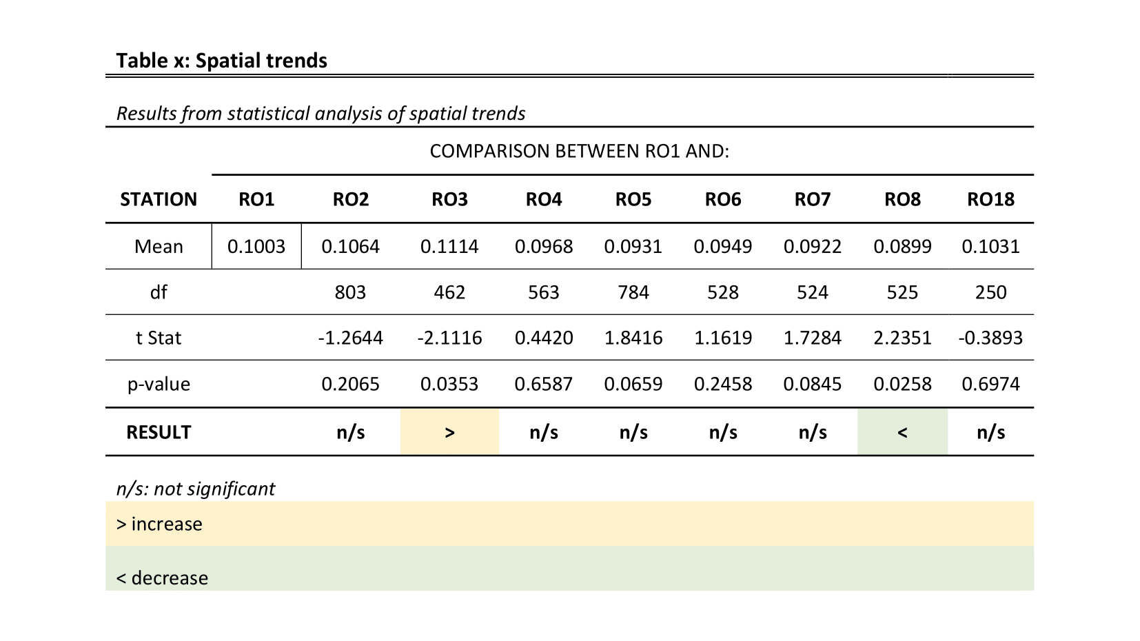
Secondary data from the ICPDR database were analysed in Excel. Annual averages were calculated and classified using TNMN standards. Spatial variation was tested using two-sample t-tests, while temporal trends were assessed using Spearman Rank Correlation.
Monthly Total Phosphorus (mg/L) measurements from nine monitoring stations (1997–2017), with ~90% data completeness. Samples were taken from the left bank of the river.
Water quality was generally good (Class I–II), though EU thresholds (0.15 mg/L) were frequently exceeded. Seasonal patterns showed higher TP in autumn/winter and lower values in summer. Spatial trends were modest, with slight downstream decreases. Temporal trends were weak, with only one station (RO3) showing a significant decline.
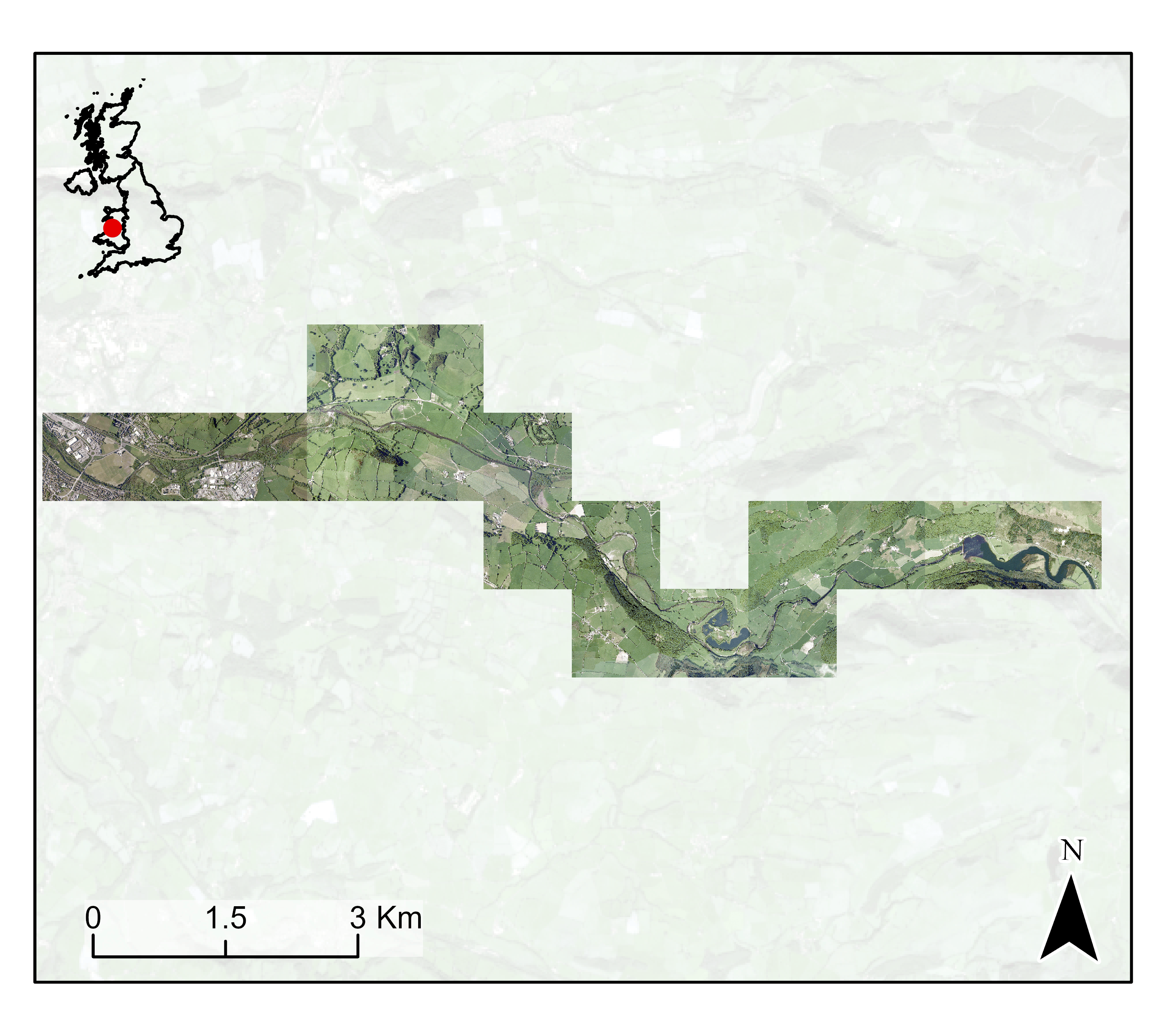
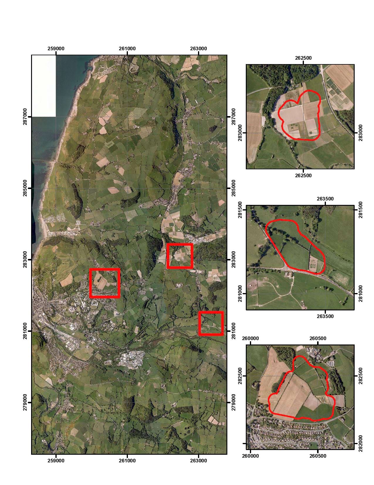
This project identifies an optimal underground gas pipeline route between Aberystwyth and the Cwm Rheidol Power Station. The design integrates geomorphological analysis, environmental constraints, and contamination risk assessment to ensure safe river crossings and long-term infrastructure stability.
To determine the safest and most cost-effective pipeline route while minimising environmental impact and avoiding high-risk geomorphological zones.
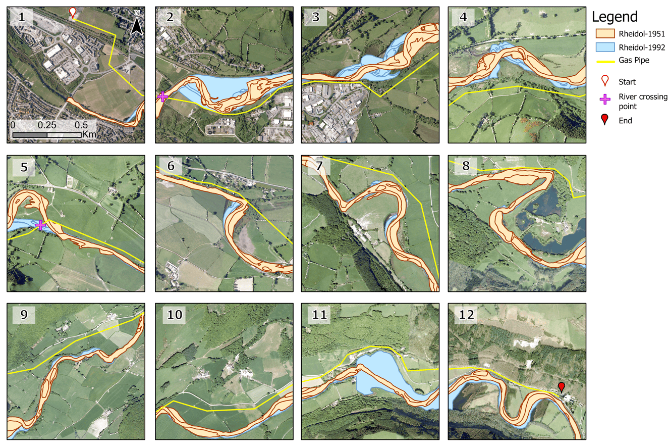
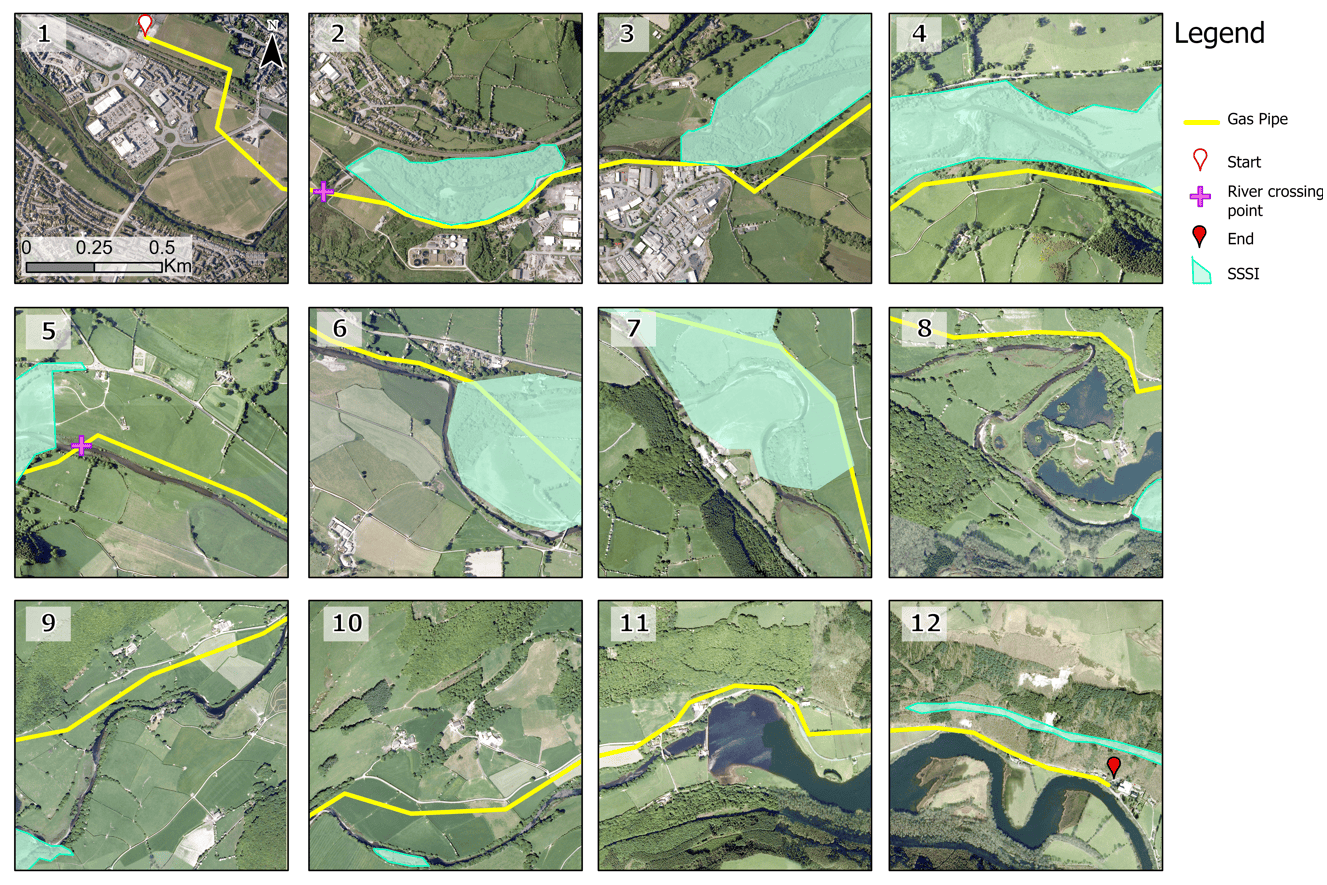
A desk-based GIS and geomorphological analysis was conducted using aerial imagery, historical channel change (1951–1992), slope and elevation data, SSSI boundaries, river flow records, and geochemical contamination mapping.
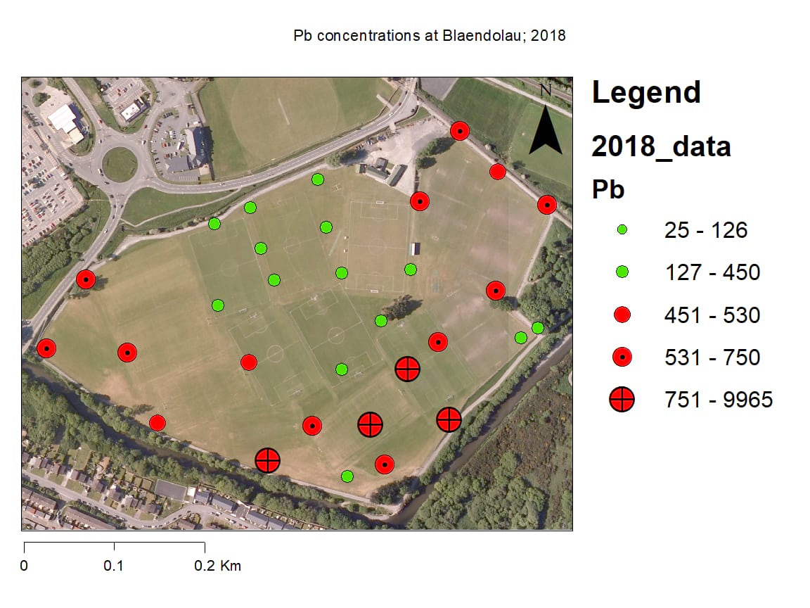
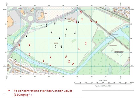
Multiple secondary datasets were used, including river channel extents, floodplain maps, environmental designations, and lead (Pb) concentration data from Blaendolau Fields. The study area was divided into 12 analytical sections.
A 13 km pipeline route was successfully designed with two river crossing points located in lower-risk geomorphological zones. The route avoids major SSSIs, steep valley slopes, and heavily contaminated floodplain areas while maintaining cost efficiency.
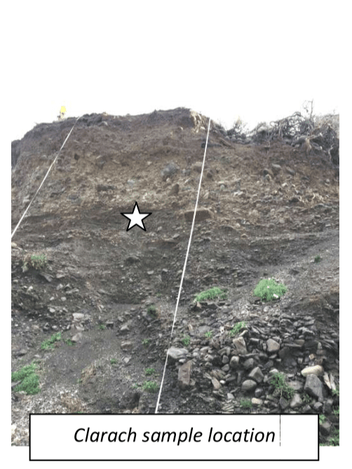
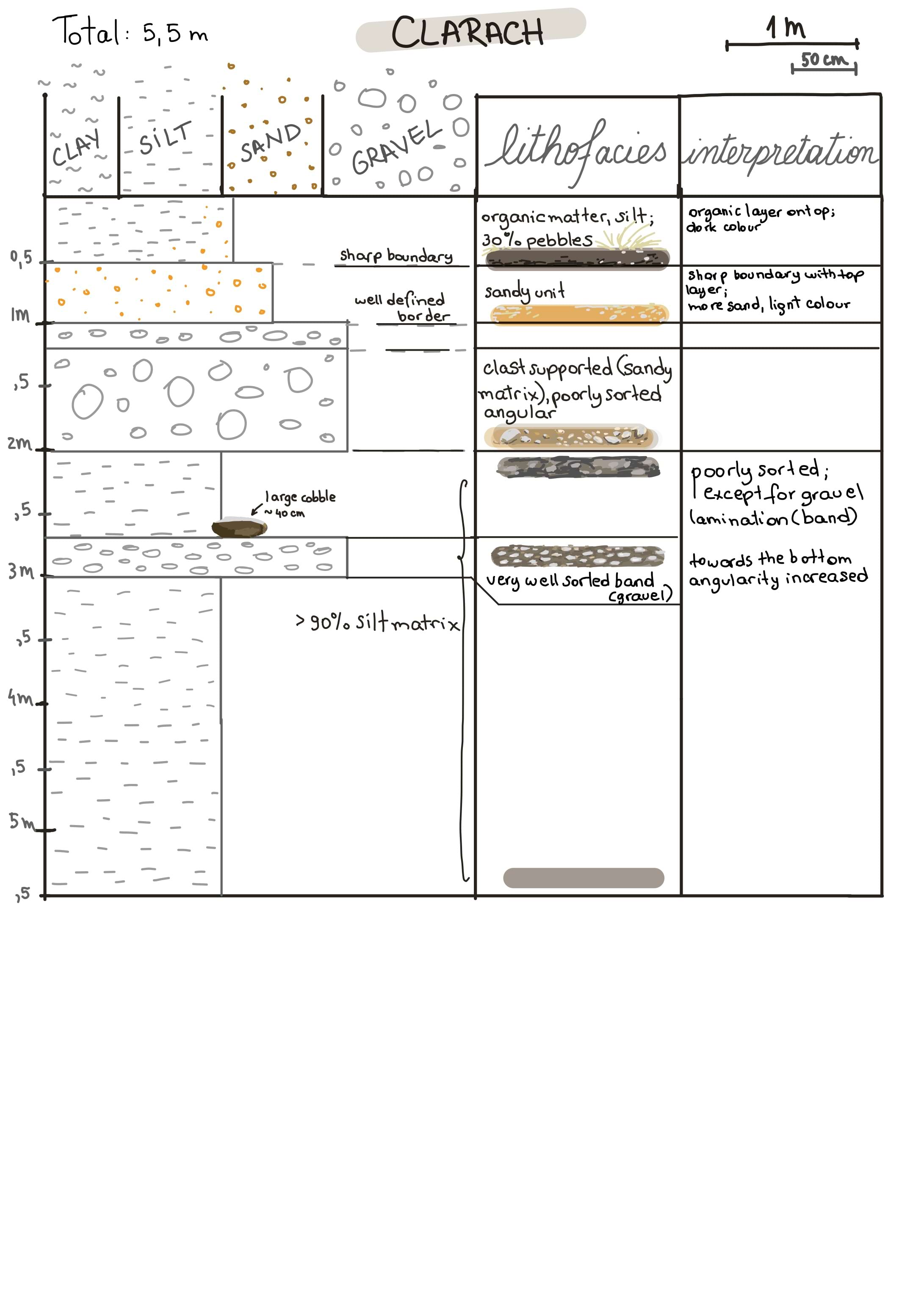
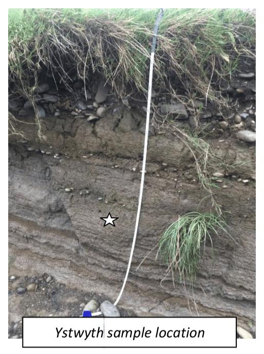
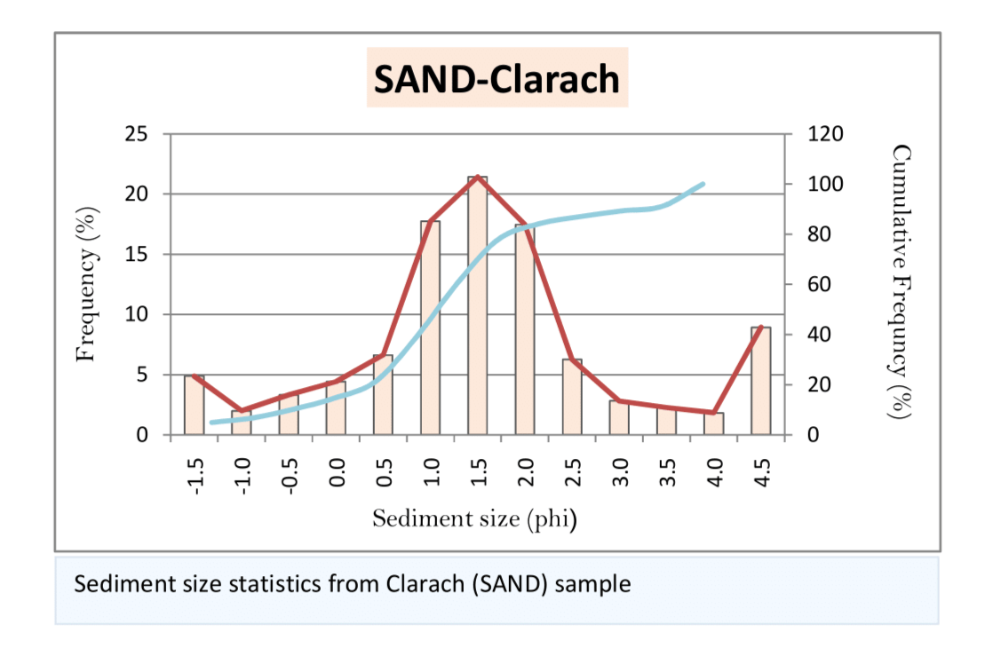
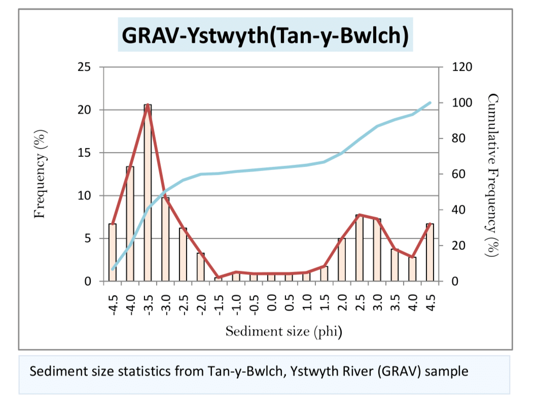
This study analyses sediment samples from Tan-y-Bwlch and Clarach to interpret depositional environments using grain size statistics, sedimentary structures, and clast analysis. Understanding sediment characteristics provides insight into transport processes and past environmental conditions.
Identify and compare sedimentary environments at Tan-y-Bwlch and Clarach using grain size analysis, sorting, skewness, and clast characteristics.
Dry sieving was used to determine grain size distributions, followed by statistical analysis of mean, sorting, and skewness. Fine fractions were analysed using the pipette method. Clast shape, roundness, and lithology were assessed using Power’s scale and RA/C40 indices.
Sediment samples from Tan-y-Bwlch (Ystwyth River) and Clarach, including gravel and sand fractions, grain size distributions, and 50-clast morphological measurements.
The Tan-y-Bwlch sample indicates a higher-energy fluvial environment with coarser, less well-sorted material. Clarach shows better sorting and more uniform grain sizes, consistent with a lower-energy depositional setting. Clast analysis further supports contrasting transport histories between the two sites.
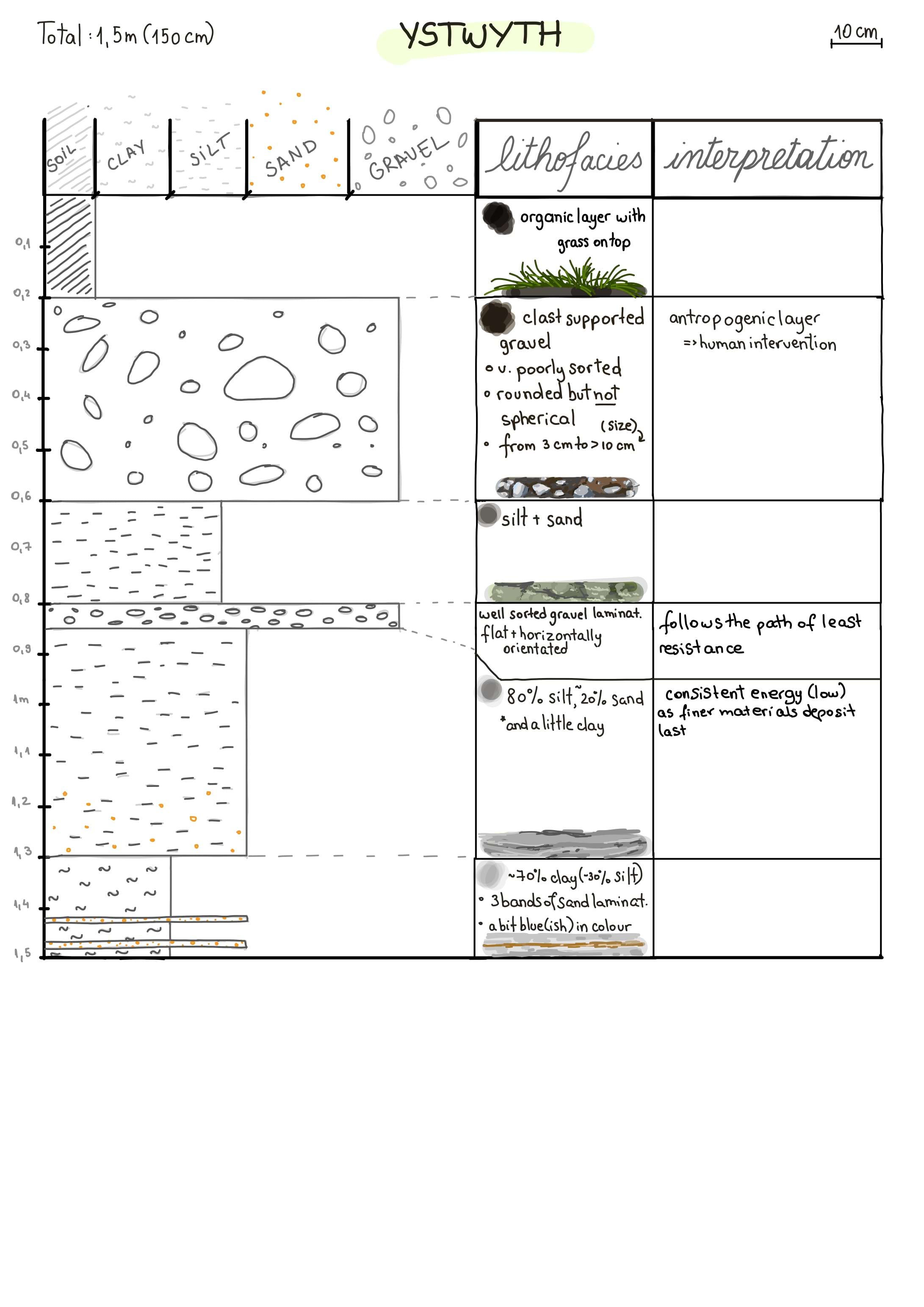
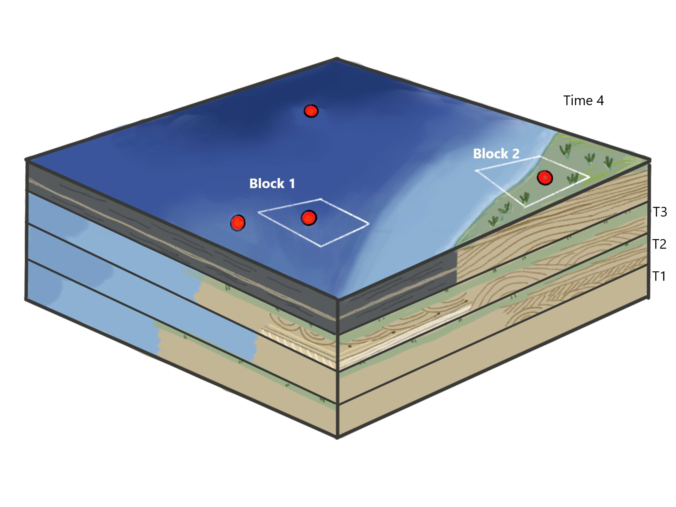
This study evaluates sedimentary environments using core logs and wireline data to assess the suitability of subsurface blocks for Carbon Capture and Storage (CCS). CCS effectiveness depends on reservoir porosity, permeability, and the presence of a sealing cap rock to prevent CO₂ leakage.
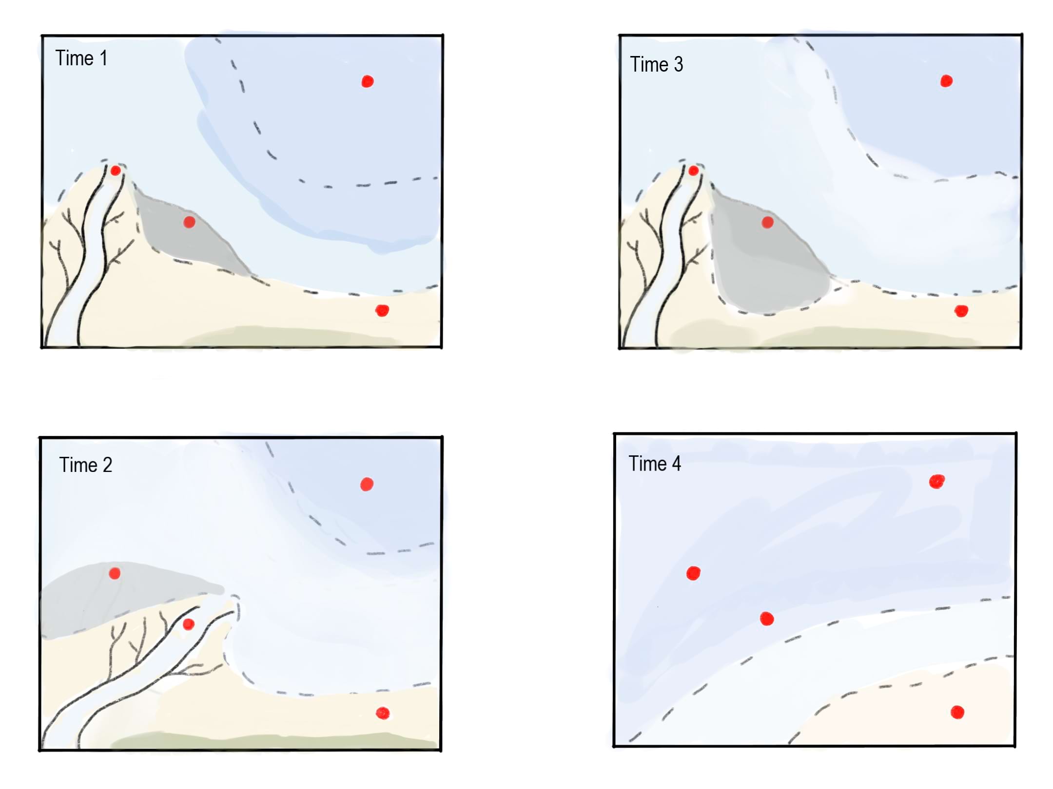
Reconstruct palaeogeography and evaluate sedimentary blocks for CCS suitability based on reservoir and seal properties.
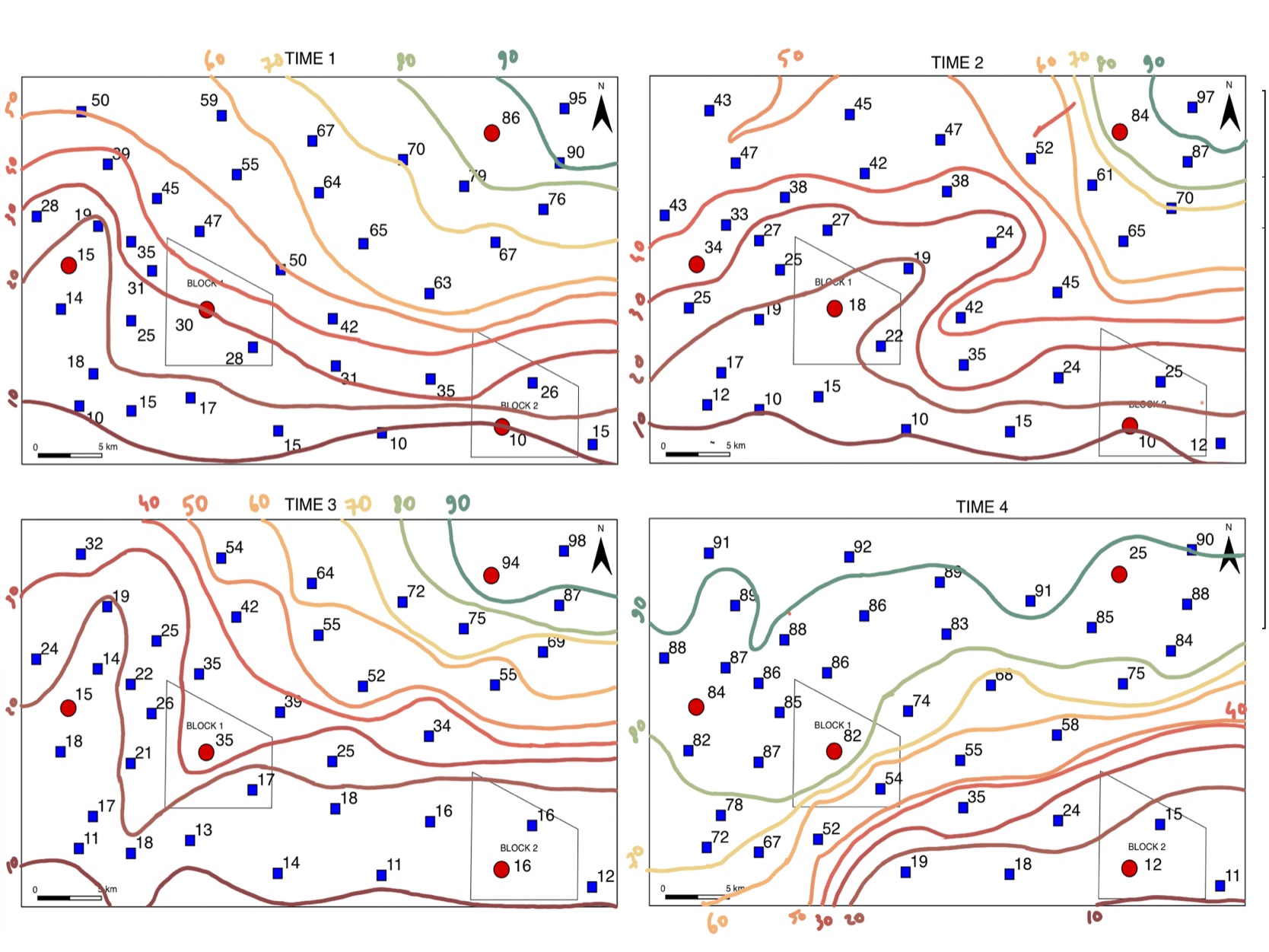
Core logs and wireline gamma data were analysed to interpret sedimentary facies and depositional environments. Volcanic ash layers were used for correlation, and contour mapping of gamma responses was used to distinguish sandstone (0–20%), heterolithic (20–60%), and mudstone (60–100%) facies across multiple time intervals.
Sedimentary core logs and gamma wireline datasets representing marine, deltaic, tidal, shoreface, and deep marine environments across multiple time intervals.
The study reveals strong spatial and temporal variability in depositional environments. Gamma contour analysis highlights clear facies partitioning, with Block 2 identified as the most suitable CCS reservoir due to high porosity and effective sealing cap rock, while Block 1 shows limited containment potential.
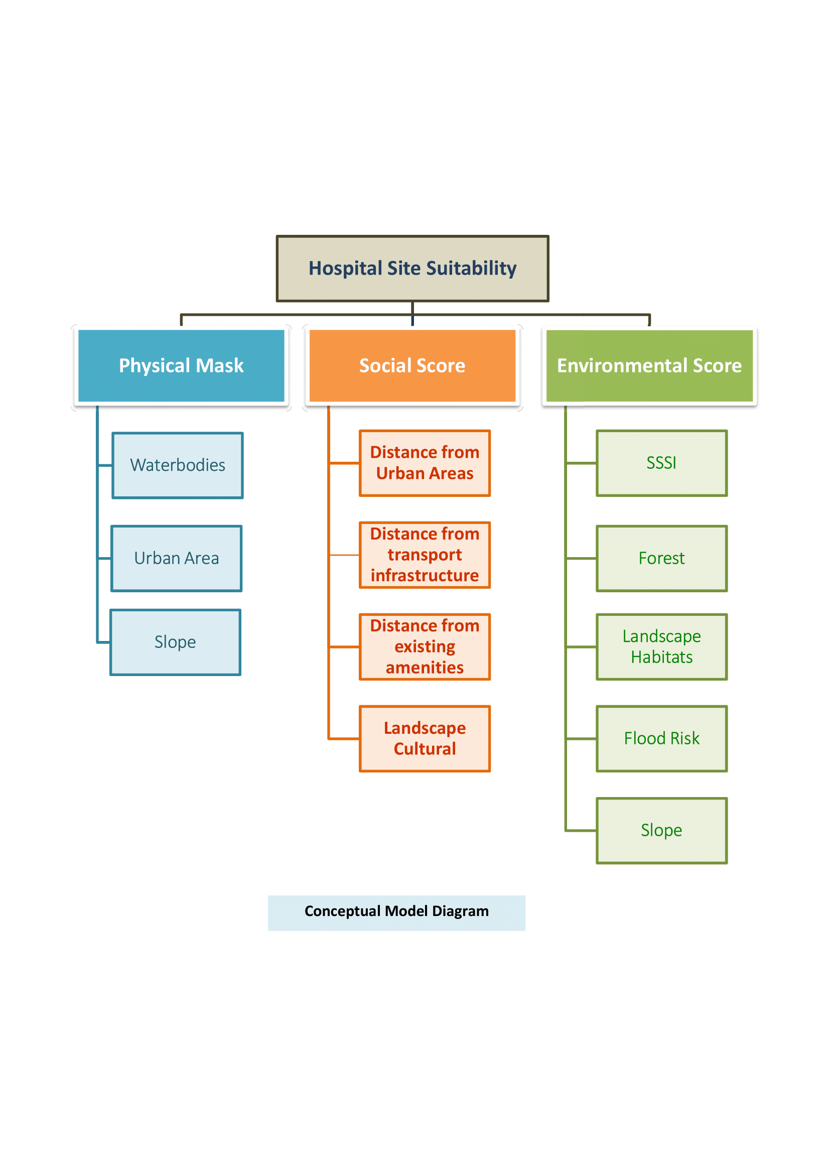
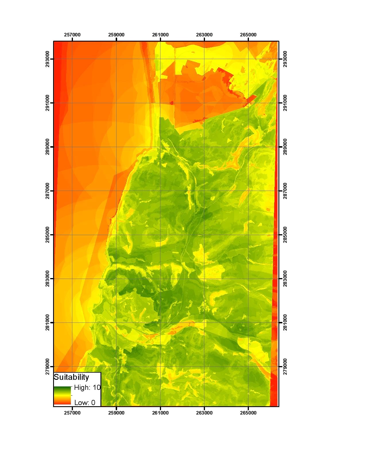
This project applies a multi-criteria GIS model to identify suitable sites for a new hospital in the Aberystwyth area. Environmental, social, and physical constraints were integrated to produce a weighted suitability surface and select optimal locations meeting spatial and accessibility requirements.
Identify and rank suitable sites for a new hospital based on environmental safety, accessibility, and physical build constraints.
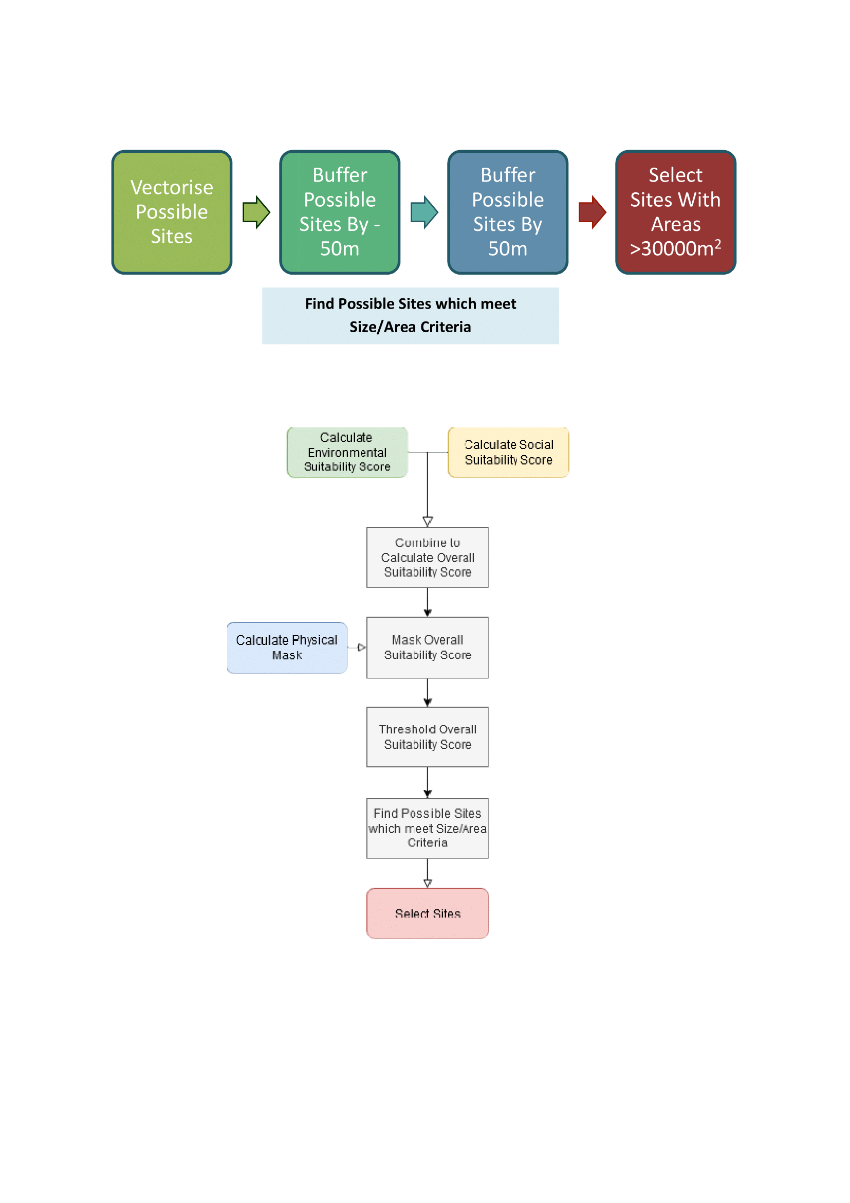
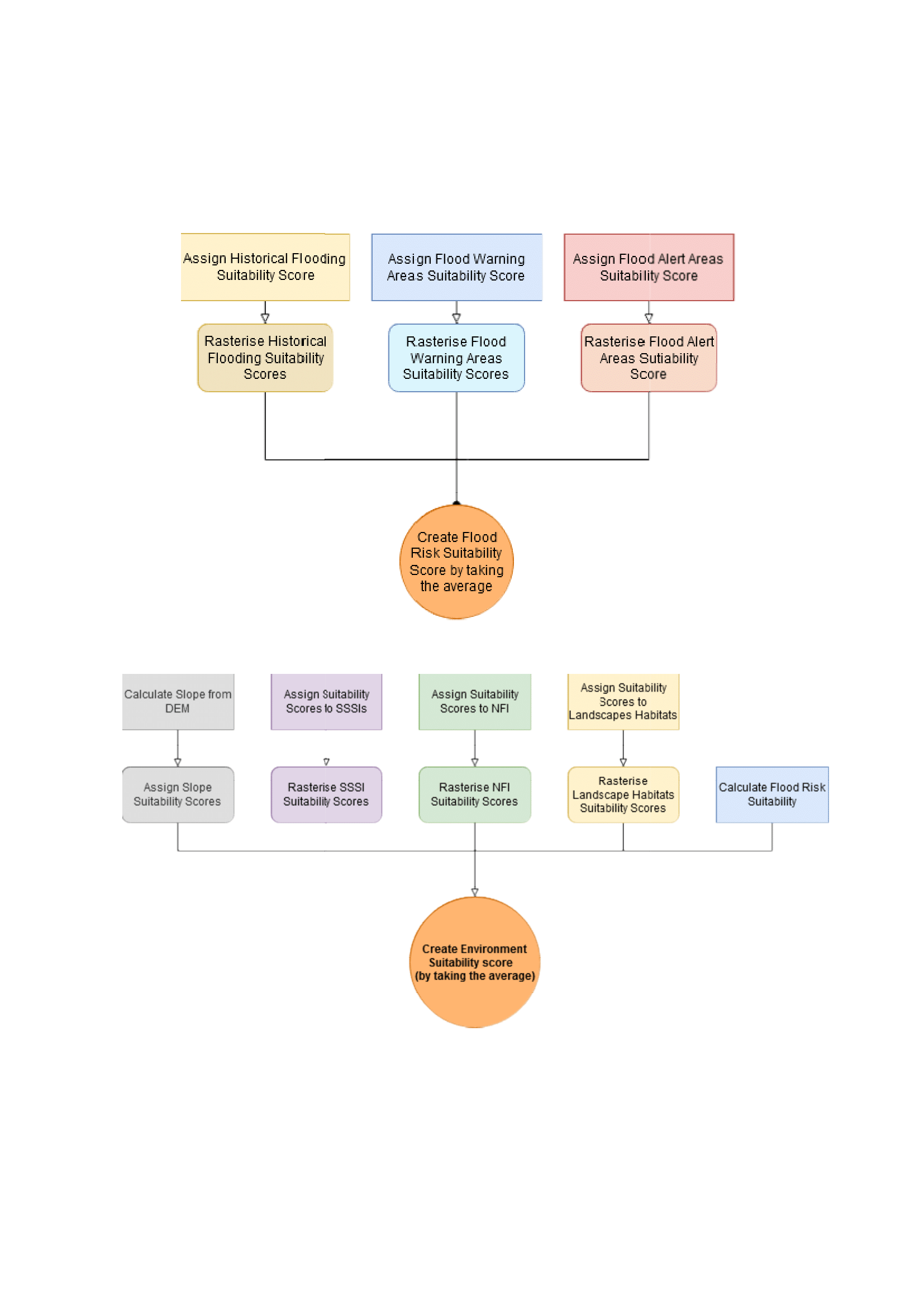
A multi-criteria GIS approach was used combining slope, land use, flood risk, transport access, and proximity to population centres. Weighted scoring was applied across environmental, social, and physical layers, followed by thresholding and size constraints (>30,000 m² and minimum width criteria) to refine final site selection.
Digital elevation models, land use data, flood risk layers, transport networks, settlement distribution, and environmental constraint datasets (including protected habitats and water bodies).
The analysis identified several high-suitability zones concentrated around accessible rural-urban corridors. Three final candidate sites were selected, with Site 1 identified as the most suitable due to balanced accessibility, low environmental constraint exposure, and strong regional service coverage.
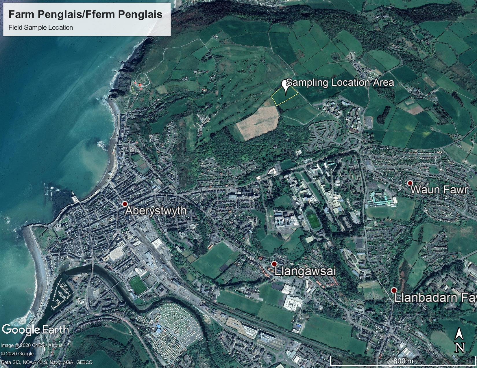
This study investigates soil properties and contaminant distribution across a hillslope transect at Farm Penglais, Aberystwyth. A combination of laboratory geochemical analysis, soil respiration measurements, and pXRF validation was used to assess soil quality, nutrient availability, and heavy metal contamination.
Characterise spatial variation in soil chemistry, organic content, and contaminant concentrations across a slope transect and evaluate analytical method reliability.
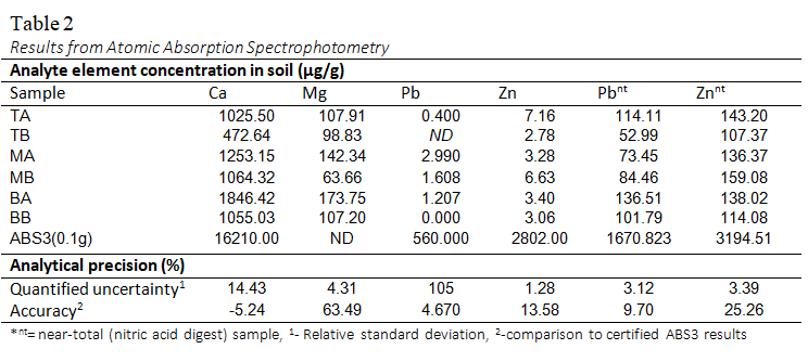
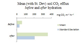
Systematic transect sampling was conducted across top, mid, and bottom slope positions with A and B horizon separation. Laboratory analyses included loss-on-ignition (organic matter), acid digestion (nutrients and metals), atomic absorption spectrophotometry (Ca, Mg, Zn, Pb), soil respiration via static chambers, and pXRF contaminant mapping.
Soil samples from multiple slope positions (n = triplicates for key samples), including pH, organic matter, carbonate content, and elemental concentrations (Ca, Mg, Zn, Pb) measured using AAS and pXRF.
Results show clear spatial variation in soil chemistry along the slope, with higher nutrient and metal concentrations in mid-slope soils. Lead contamination was low overall but spatially variable. pXRF results showed strong agreement with AAS, confirming method reliability despite minor precision differences.
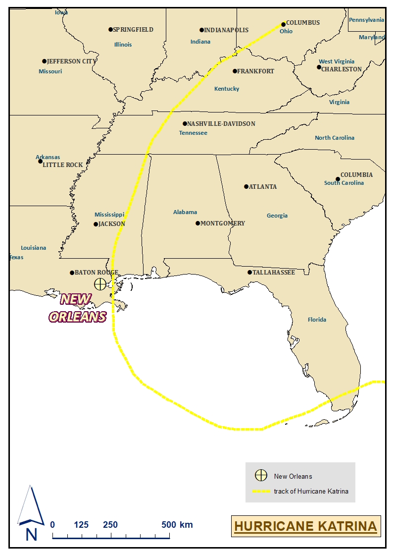
This study examines Hurricane Katrina to evaluate how “natural” disasters are shaped by human systems. It combines spatial and socio-economic data to assess how environmental risk and inequality influenced impacts and recovery across New Orleans.
To investigate how physical exposure and social vulnerability interacted during Hurricane Katrina, and whether impacts were unevenly distributed across New Orleans neighbourhoods.
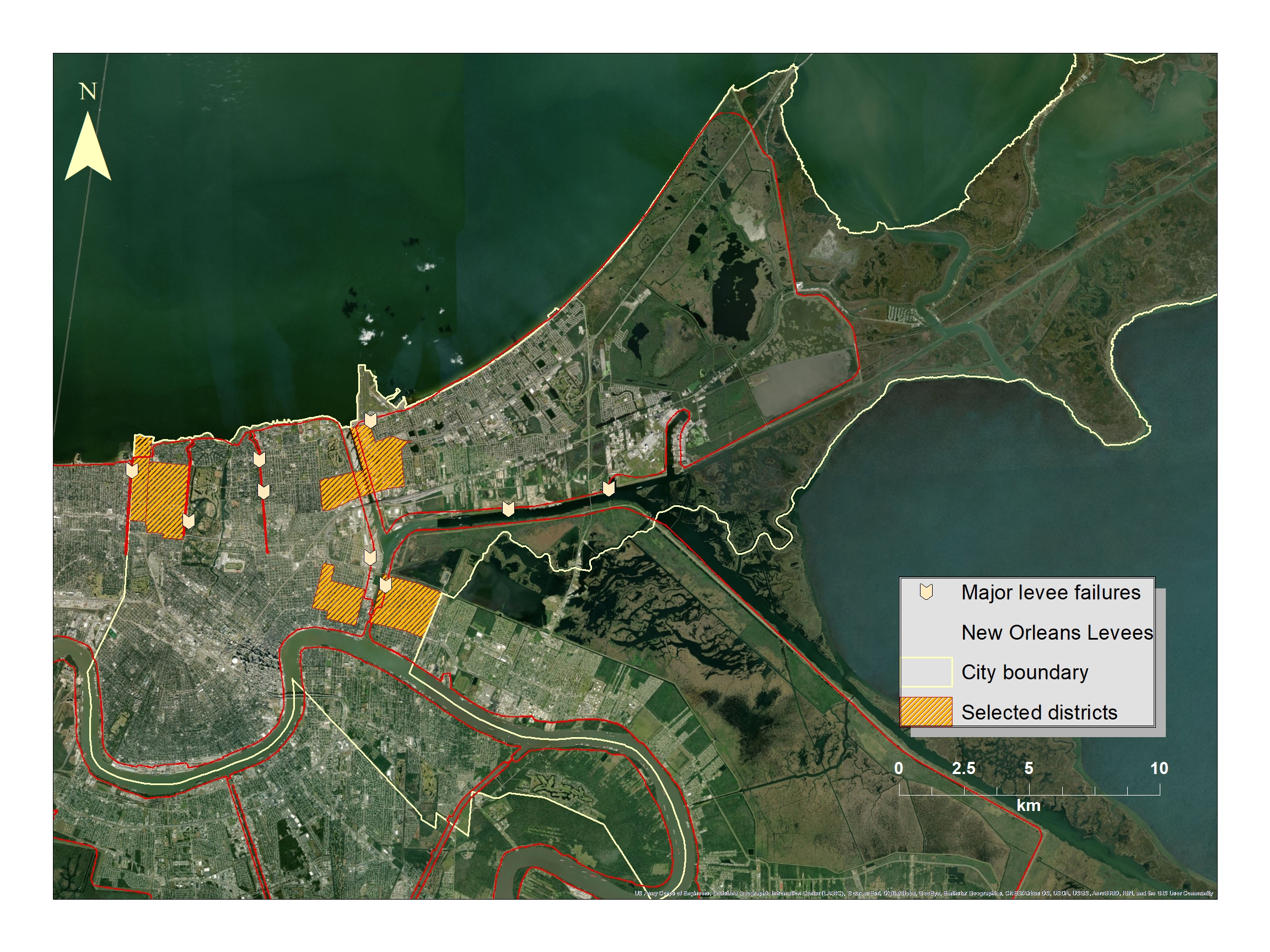
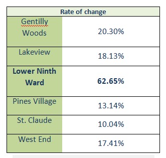
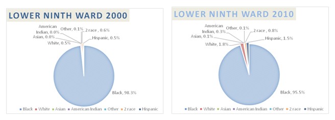
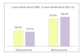
GIS-based spatial analysis was combined with census and income data. Elevation, flood extent, and levee failure data were mapped alongside population change and socio-economic indicators to assess vulnerability and recovery patterns.
Elevation models, hurricane track and flood extent data, levee failure locations, and neighbourhood-scale census datasets including population change, ethnicity, and household income (pre- and post-Katrina).
Flooding and damage were highly uneven across the city, with the greatest impacts in low-lying areas such as the Lower Ninth Ward. Recovery patterns show strong links between socio-economic status and resilience, suggesting that disaster impacts were shaped by both physical exposure and social inequality.
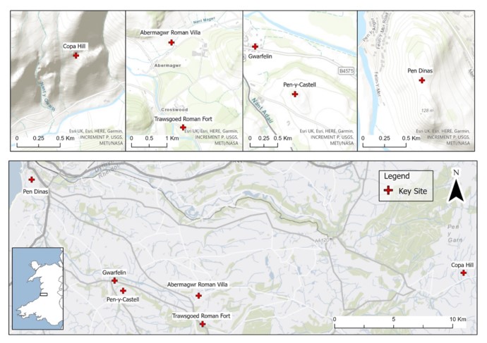
This study maps and interprets key archaeological sites across the Ystwyth Valley, integrating spatial distribution, site chronology, and palaeoenvironmental evidence. It reconstructs long-term human activity from the Neolithic to the medieval period, including settlement, burial, military occupation, and mining landscapes.
To analyse the spatial and temporal distribution of archaeological sites in the Ystwyth Valley and reconstruct how human activity evolved in relation to landscape and environmental change.
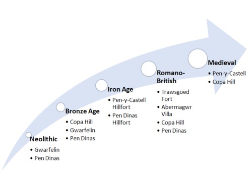
Archaeological site records were compiled and ordered chronologically to construct a regional timeline. Site interpretation was supported using published excavation data, aerial photography, geophysical surveys, and palaeoenvironmental evidence where available.
Multi-period archaeological sites including Neolithic burial contexts, Bronze Age mining and agriculture, Iron Age hillforts, Roman military and civilian settlements, and medieval landscape reuse across the Ystwyth Valley.
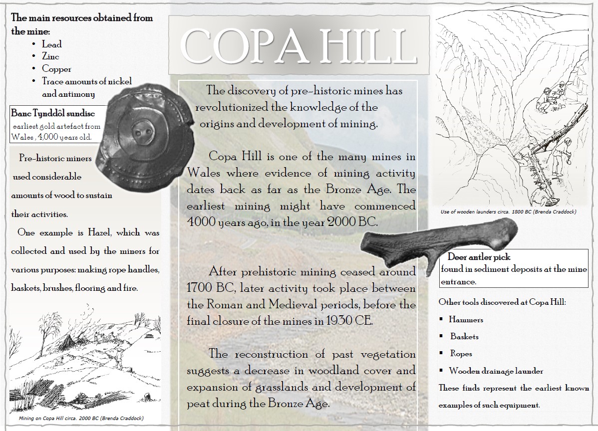
The valley shows continuous human occupation with shifting land use over time. Early ritual and burial landscapes transition into agricultural and extractive activity, followed by Roman military occupation and later reuse of elevated defensive sites. Mining evidence indicates long-term industrial activity shaping upland environments.
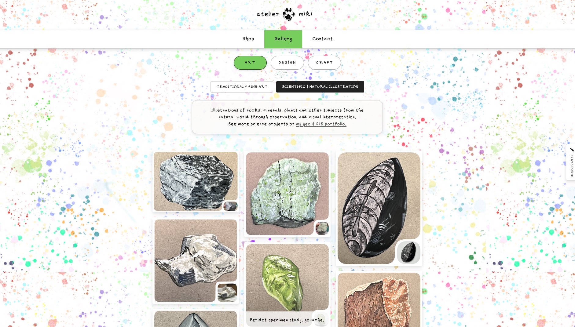
Development of a custom art portfolio website for Atelier Miki, designed to showcase visual work through a minimal, gallery-focused interface. The project focuses on balancing aesthetics and usability, creating a responsive and visually coherent digital space for artistic presentation.
To design and develop a clean, immersive online portfolio that enhances artwork presentation while maintaining strong visual identity and usability across devices.
The website was built using HTML, CSS, and JavaScript with a focus on modular layout design. A grid-based gallery system, interactive slideshow components, and responsive breakpoints were implemented to ensure cross-device compatibility.
The final website presents a cohesive digital portfolio that highlights artwork without visual distraction. It provides intuitive navigation, responsive layout adaptation, and a strong alignment between brand identity and user experience.
Features a custom typeface created from the artist’s own handwriting alongside bespoke cursors, interactions, and UI elements designed exclusively for the project.
working on other projects, more coming soon
 OBSERVATIONS